2017-09-30 03:12:48熊爸
往Cape Flattery賞鳥去
第四天的行程,是從Port Angeles(天使港),開到美國下四十八州最西北邊的Cape Flattery, 來回大約一百七十哩,是這次開車行程中最長的,但以一天的開車距離來講,賞鳥欣賞風景的時間其實是很充裕的。

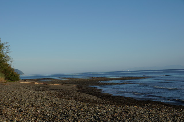
全程走州道WA 112號公路,有一半路程靠海,車少風景好。從Port Angeles出發,公路先在內陸行,一旦下坡轉近海邊,熊爸要同時注意鳥況與有沒有可停車的地方。沒多久就看到遠方海灘有白白的東西(就是鳥),所以下車探究竟。
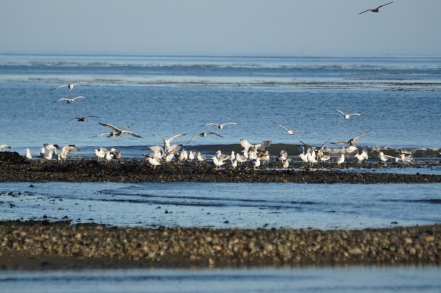
是鷗科,不想走太近嚇跑了鳥兒,就遠拍欣賞,不再管是哪種海鷗。
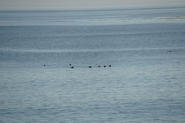 海上更遠處有一群鳥,應該是新種,但太遠無從辨識,不過熊爸並不急,反正今天有的是機會看海鳥。
來之前有標記幾個沿路的可能鳥點(多是海邊小公園,可以下車伸展筋骨兼放水),第一個叫做Pillar Point Recreation Area,屬州立公園系統,但其實是一個迷你公園,讓遊客歇歇腳看看海灣的地方。
早上是退潮時間,但沒有鳥出現在公園這邊
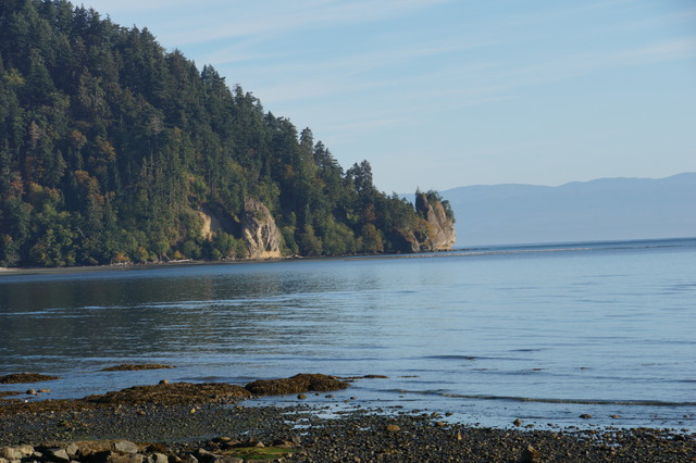
海灣對面的岬角下面依稀可見白色一線,是一群鷗科鳥,待在退潮出現的沙洲,看樣子還沒睡醒,還沒有開始覓食,海鳥的作息與陸鳥差別很大。
再下來開到Clallam Bay這個小村莊,WA 112號公路在這裡左轉90度,轉彎處就是一個海濱公園叫Clallam Bay Spit。
從停車處走過樹林過了小橋,就到了沙灘上。
早上此時光線很好展望也佳,除看到一隻白腹魚狗外,沒見到任何海鳥。
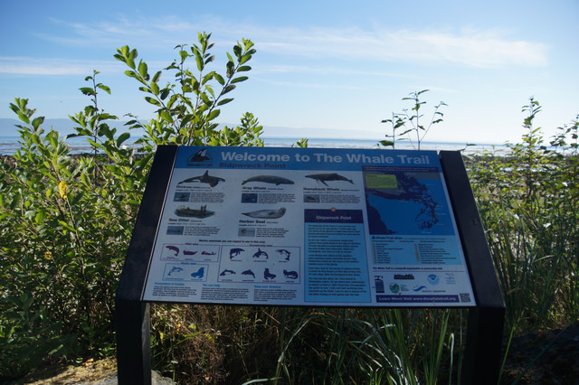
再上車往Neah Bay開,大約在Neah Bay前10到15哩左右,道路變窄,延海岸修築,但景色被一排防風林擋住,路旁有很多的pull-over可停車,有解說牌,遊客穿過樹木就可以到海邊戲水。
這一段是石礫的海岸,還是退潮時刻,沒有鳥。等回程時這裡漲潮,就精采了。
下面這段是今天旅程的重要的說明了。Cape Flattery是美國四十八州的西北角,但不屬於國有土地也非私人財產,而是位在印地安人保留區(Makah Indian Reservation)內,Neah Bay這個小鎮則是保留區的行政中心。美國印地安保留區有一定的自治權,之前有做功課,在這個保留區的路邊停車(如欣賞風景),以及最重要的去Cape Flattery,一定要買遊憩許可證,所以熊爸熊媽一進城,馬上去當地最大的超市花10元美金買許可證,還買了許多零食當午餐,因為Cape Flattery可是沒有東西賣的。
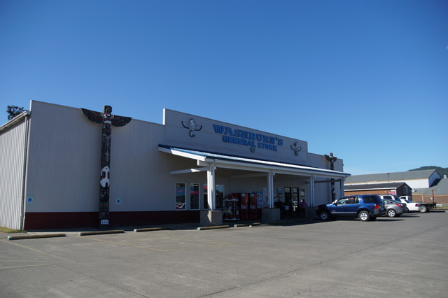
這家超市其實不小,但還是用general store這種古早味名稱

提醒遊客要買許可,這張許可與華州州立公園的Discover Pass一樣掛在照後鏡上,熊爸有帶回台灣,只是不知放哪去了。
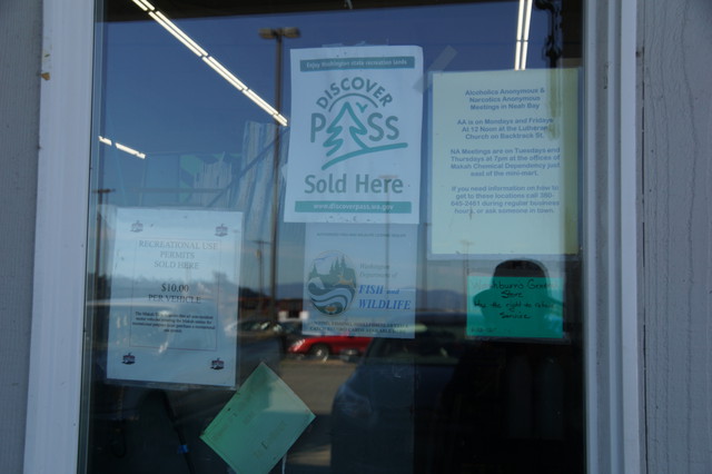
也兼賣Discover Pass與華州打獵釣魚證
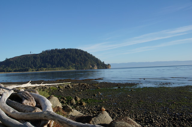
Neah Bay顧名思義是一個臨海灣的小鎮,海水湛藍,看起來沒有什麼污染。以為會有些漁船,也沒看到。


這邊又有一群海鷗,不過距離稍遠,且又在休息,不易辨識。這張是熊媽拍熊爸拍鳥,熊爸還是不要露相比較好。
拍完就朝向Cape Flatter前去。
全程走州道WA 112號公路,有一半路程靠海,車少風景好。從Port Angeles出發,公路先在內陸行,一旦下坡轉近海邊,熊爸要同時注意鳥況與有沒有可停車的地方。沒多久就看到遠方海灘有白白的東西(就是鳥),所以下車探究竟。
是鷗科,不想走太近嚇跑了鳥兒,就遠拍欣賞,不再管是哪種海鷗。
海上更遠處有一群鳥,應該是新種,但太遠無從辨識,不過熊爸並不急,反正今天有的是機會看海鳥。來之前有標記幾個沿路的可能鳥點(多是海邊小公園,可以下車伸展筋骨兼放水),第一個叫做Pillar Point Recreation Area,屬州立公園系統,但其實是一個迷你公園,讓遊客歇歇腳看看海灣的地方。
早上是退潮時間,但沒有鳥出現在公園這邊
海灣對面的岬角下面依稀可見白色一線,是一群鷗科鳥,待在退潮出現的沙洲,看樣子還沒睡醒,還沒有開始覓食,海鳥的作息與陸鳥差別很大。
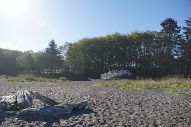
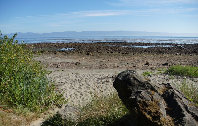
再下來開到Clallam Bay這個小村莊,WA 112號公路在這裡左轉90度,轉彎處就是一個海濱公園叫Clallam Bay Spit。
從停車處走過樹林過了小橋,就到了沙灘上。
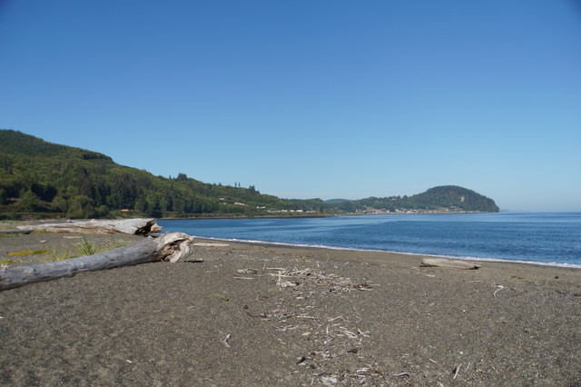
早上此時光線很好展望也佳,除看到一隻白腹魚狗外,沒見到任何海鳥。
再上車往Neah Bay開,大約在Neah Bay前10到15哩左右,道路變窄,延海岸修築,但景色被一排防風林擋住,路旁有很多的pull-over可停車,有解說牌,遊客穿過樹木就可以到海邊戲水。
這一段是石礫的海岸,還是退潮時刻,沒有鳥。等回程時這裡漲潮,就精采了。
下面這段是今天旅程的重要的說明了。Cape Flattery是美國四十八州的西北角,但不屬於國有土地也非私人財產,而是位在印地安人保留區(Makah Indian Reservation)內,Neah Bay這個小鎮則是保留區的行政中心。美國印地安保留區有一定的自治權,之前有做功課,在這個保留區的路邊停車(如欣賞風景),以及最重要的去Cape Flattery,一定要買遊憩許可證,所以熊爸熊媽一進城,馬上去當地最大的超市花10元美金買許可證,還買了許多零食當午餐,因為Cape Flattery可是沒有東西賣的。
這家超市其實不小,但還是用general store這種古早味名稱
提醒遊客要買許可,這張許可與華州州立公園的Discover Pass一樣掛在照後鏡上,熊爸有帶回台灣,只是不知放哪去了。
也兼賣Discover Pass與華州打獵釣魚證
Neah Bay顧名思義是一個臨海灣的小鎮,海水湛藍,看起來沒有什麼污染。以為會有些漁船,也沒看到。
這邊又有一群海鷗,不過距離稍遠,且又在休息,不易辨識。這張是熊媽拍熊爸拍鳥,熊爸還是不要露相比較好。
拍完就朝向Cape Flatter前去。
上一篇:奧林匹克國家公園之新月湖
下一篇:Cape Flattery